Strengthening adaptive capacity across Zimbabwe's economy & communities
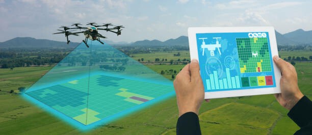
Zimbabwe Environmental Technologies (ZET) develops climate adaptation strategies for key sectors and delivers cutting-edge magnetic, low-altitude drone surveys using magnetometer-equipped systems for geological mapping, pipeline & underground infrastructure detection, abandoned-well locating, and more.
Get in touchContact
What we do
Climate Adaptation Planning
Sectoral assessments, vulnerability analyses, and context-specific adaptation roadmaps for agriculture, water, energy, health and urban planning.
Capacity Building
Workshops, technical training and community engagement to strengthen local adaptive capacity and disaster preparedness.
Policy & Advisory
Support for policy development, mainstreaming climate risk into planning and compliance with regional/international frameworks.
Magnetic & Low-Altitude Drone Surveys

Overview
ZET operates low-altitude drones equipped with precision magnetometers to collect high-resolution magnetic data while flying close to the ground. This approach provides superior detail for detecting subsurface features compared with higher-altitude aerial surveys.
Applications
- Mapping mineral deposits and structural geology for exploration
- Detection and mapping of pipelines and buried infrastructure
- Locating abandoned wells, culverts, and other subsurface hazards
- Environmental baseline surveys and mine-affected area assessments

Why low-altitude magnetics?
Flying closer to the ground increases spatial resolution and sensitivity to near-surface anomalies while reducing noise and improving mapping accuracy — critical for targeted exploration and infrastructure integrity assessments.
Equipment & data
We deploy drones with stabilized magnetometer mounts, GNSS positioning, and onboard data logging. Processed deliverables include geo-referenced magnetic anomaly maps, gridded data, cross-sections and detailed reports with recommendations.
Services & Projects

Field Surveys
End-to-end survey planning, permitting, flight operations, and data acquisition in rugged and remote areas.
Data Processing
Magnetic diurnal correction, filtering, gridding, and anomaly interpretation by geophysicists.

Consulting
Interpretation workshops, feasibility studies and recommendations that link geophysical results to operational decisions.